You've never seen a highway map like this before!
This map book helps you navigate the Tokaido, one of the five highways established during the Edo period, without getting lost.
We recommend this book to anyone walking the Tokaido.
It's a practical and delightful book, combining easy-to-read text with portability.
The Tokaido is one of Japan's most iconic highways.
Even after 300 years, much of its original form remains, making it a popular hiking trail.
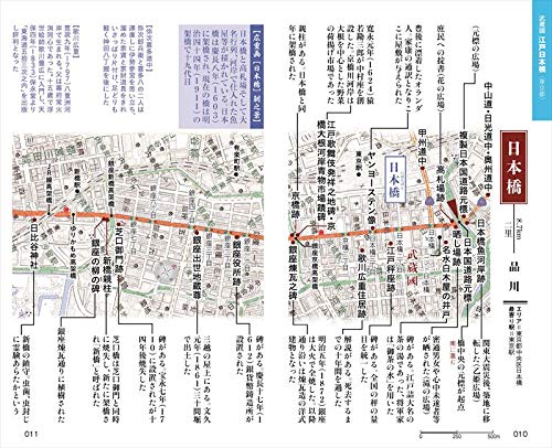
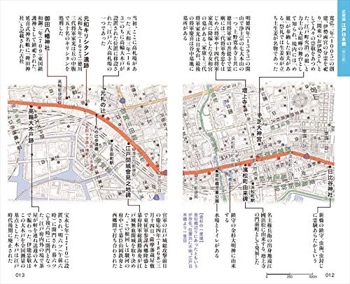
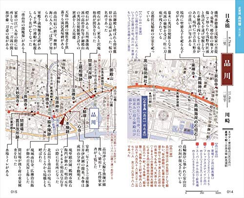
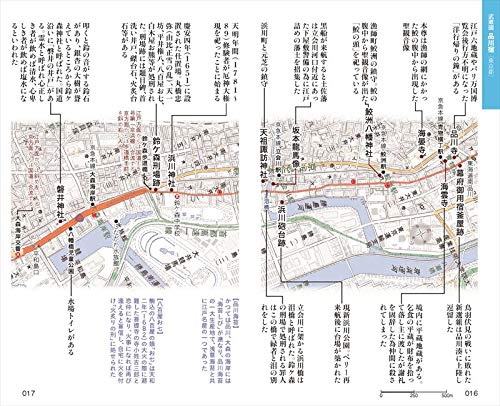
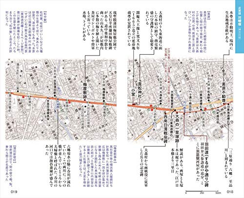
This book covers the eastern half of the approximately 500-km Tokaido, from Edo Nihonbashi to Mitsuke-juku.
It covers the route from Edo Nihonbashi to Mitsuke-juku, covering the post towns and famous places along the route, as well as current town names, convenience stores, restrooms, and accommodations.
It also includes information on now-defunct highway landmarks and post towns based on the Edo-period "Yadomura Taigaicho" (Post Town Register).
It's also a valuable historical read, allowing you to reminisce about times gone by while you walk.
This is the first time that a route map of the Waki-Okan and Hime-kaido roads, which run north of Lake Hamana, has been published in Japan.


![[Bold Large Print Book] Yanagibashi Monogatari: Read Shugoro Yamamoto's Works In One Go Without Wearing Glasses](https://img.joomcdn.net/ffcde987c7378df47743c04b3f8e4a24a977c992_70_100.jpeg)